Categories
Alaska Heida introduction Mountain Lion natural reintroduction repoplation Southeast Alaska Tlinkit

A Cougar Addendum: Self Reintroduction to Alaska

As we are learning, or perhaps you learned long ago, the story of the environment and man, and the idea of an ideal state of nature influenced or uninfluenced by man, is a bit of a complicated question…. there is not only science involved here but philosophy.. this is a short entry however, so I will try to cut to the chase..
The Cougar is introducing it’s self, or reintroducing it’s self, to Alaska..
Whether to chalk this up to Hope or Fear is a matter of question, but I’m going to toss it in the Hope category.
http://www.adfg.alaska.gov/index.cfm?adfg=wildlifenews.view_article&articles_id=26
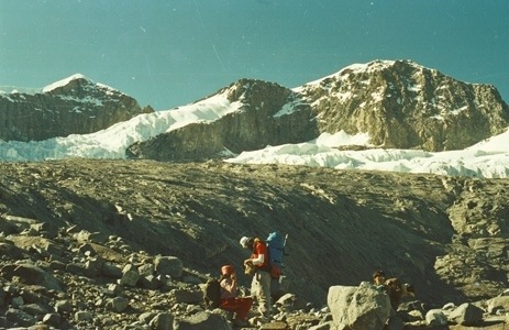
Reason why it might belong in fear: Global warming might be making previously inhospitable territory hospitable, but I kind of don’t buy that in this situation because the lands of South East Alaska, where they are most likely to live, haven’t changed that much.. what a solid land it is… amongst the most beautiful places in the world I might add.. to see the Lynn Canal or perhaps gaze across Frederick Sound from Mitkoff Island with whales breaching is to behold something special.

Now we could get complex and say that perhaps they were out competed by other species, the Lynx and the Wolf, the Bears and the Wolverines, but these species all co-habitate with it all over Canada, or did,and I think they all got along fine with plenty to eat most of the time. It’s a tricky matter to place the blame on indigenous groups, as we tend to assume, and there are kind of post enlightenment arguments perhaps in the first place, although some natives might argue otherwise, that most of the damage in the world was done, if you can call it damage, by Europeans in the post Colombian onslaught of global markets and the unification of all the global techniques for surviving and thriving that has been occurring since 1492.. complex indeed, and made more complex by the book 1491 by Charles Mann, that does inform the reader, if they had made assumptions otherwise, just how complex some Pre-Colombian cultures were, and how extensive their impact on the land might have been. I have some knowledge of the Tlingit and Heida Cultures, and they were a pretty impressive bunch before we showed up, yeah, the totem pole guys, and as much as some of the interior tribes of the great northern areas like the Athabaskans might not have been too culturally complex or tough on the land, there is a chance that the Tlingit or Heida could have gotten together and gotten rid of a bunch of Mountain Lions… anyhow, all speculation, and since the age of the rifle up there, who knows, but I figured I would toss this one in the hope category.. why not… mountain lions are cool…or, to be coldly scientific about my feelings towards felines, as this post kind of suggests, maybe I just have toxoplamosis..
http://en.wikipedia.org/wiki/Toxoplasmosis
Like you didn’t have enough to worry about in the wilds of Alaska, enjoy this too.. I can’t wait to bump into one..`
Addendum September 2014:
20 months after writing this, I had the occasion to talk to a pair of Canadian Conservation officers whose territory appeared to be North West British Colombia. They are basically national game wardens, and they were working the areas along the Cassiar Highway, Rt. 37, that runs behind the Alaska Panhandle to the east. The Coastal Range that backs up to towns like Juneau and Wrangell is an uninterrupted wilderness that the Cassiar, usually only 20 feet wide and barely habituated, a town or settlement every 50 miles perhaps, hardly separates from the wilds to the north and east. I asked these guys about Mountain Lions, which they casually referred to as ‘Cats’ in response, a reference so casual I could tell they were bumping into them. They told me they just had their first issues in Whitehorse, Yukon, which would definitely have been thought of as way too far north, way too cold normally (Whitehorse can get stuck at 50 below F, it’s the Canadian equivalent of Fairbanks culturally and geographically) and that sightings around the Cassiar were becoming regular. The confirms the move. I did speculate to myself after meeting them, the possibility that instead of man displacing them, perhaps wolves might have, when logging both in the Alaska Panhandle and in this adjoining area of Canada was much more intense. It was banned under the Clinton Administration in the 90’s in the Alaska Panhandle, a sweetheart deal for the cruise ship industry which did hurt some local economies, but has benefited tourism perhaps more than compensatarily. Maybe the logging back then led to prey scarcity that had Wolves eliminating competition. I also saw two coyotes in the same area in this visit, also perhaps new territory for them. Their short legs distinguish them from Wolves. Both areas are recovering from all the logging as the Puma’s enter…

Categories
Dead Sea Dead Sea Level Dead Sea Works Evaporation Pans Jordanian Red Sea Project JRSP Red Sea Dead Sea Canal

The Jordananian De-Sal Canal that will fill the Dead Sea back up..

So I love the Ol’ USA, but my posts lately have gotten a bit domestic… Us Americans, we can be a bit self involved.. put 20 guys on the moon, create the Super Bowl and Southern Bar BQ, and all the sudden the rest of the world don’t exist. We do fix problems when we get around to it, and our true freedom of the press, with a few warts through it may have, and our love for the Internets, this system of tubes, makes for easy blogging about just about any endangered hog nose snail, and boondoggle public works to fix a problem we never should have had in the first place under the sun.. Believe me, I understand.. but I do want to bring in some exotic elements here..
The world is a big place, and as we are learning more and more, it’s environmental problems are interconnected, so I feel a need to write about a piece of potential hope someplace else, someplace exotic, someplace complicated.. and I’m not sure it gets any more complicated than the Middle East. Although Jordan is a relatively uncontentious little place, so this story might be kind of cut and dry, and well, distantly hopeful after all.. but ah the setting, what a complex pile of sand it is…ah, Israel, The West Bank, the Dead Sea, lowest place on Earth, extension of the Great Rift Valley, but if the Rift Valley was the Cradle of Human life, than the areas around the Dead Sea do kind of compete for being the cradle of Human Contention.. but nature is neutral to all that, nature either has no opinions, or just kind of wants to survive… we project almost everything else onto it, from needs to value, but it’s fair to say that given that, the Dead Sea is kind of a cool place.. well, not cool, it’s pretty damn hot.. lemme see.. Dead Sea Weather Report…
http://www.thedailyshow.com/watch/thu-july-13-2006/emotional-weather-report
well, that’s kind of it, but this is a bit more specific.. congrats on the record by the way, Middle East!
http://www.google.com/search?q=dead+sea+weather+report&aq=f&oq=dead+sea+weather+report&sourceid=chrome-mobile&ie=UTF-8
So all other problems aside, the Dead Sea, a bit like the Aral Sea now famously, is shrinking, rapidly, and it’s not a natural occurrence..
what is happening is that an Israeli firm set up a Salt Works on the south end of the Sea complete with some big evaporation pans, actually, more like a potash mine, and it has dropped the level of the sea precipitously… 1 meter a year in recent times.. there is an eerie photo I once saw of a hotel from the 60’s that used to be beach level, but however is now like 30 feet up, but I can’t seem to find it, perhaps the hotels that do exist somehow managed to get rid of it, but here is some data:
http://saveoursea.org.il/?p=329
http://www.h2ome.net/en/2011/03/the-blue-peace/
http://guyshachar.com/content/blog/2011/live-dead-sea-photos-from-a-winter-day/
http://en.wikipedia.org/wiki/Dead_Sea
scroll down to the environmental bits if you want to skip all the history..
Anyhow, so it’s coming apart, turning into the Salton Sea or the Aral Sea, one of those disasters that you hear about but few go to see, but oddly, about a million people a year go to float there, it’s kind of a pass time in Israel, go down and turn your hair all kinky…. they just keep building the hotels closer and closer, and tearing down the old ones, or now they are even splitting the salt pan level from the northern part of the sea so they don’t have to move the hotels,
http://www.restorationplanning.com/deadsea.html
The Dead Sea Works, the company that evaporates most of the water, allegedly went on a huge ‘Greenwashing Campaign’, to displace blame, but their production goes on as usual
http://www.iclfertilizers.com/Fertilizers/DSW/Pages/BUHomepage.aspx
and no one has done anything about the falling sea levels, yet..
There was once a proposal to create a ditch from the Mediterranean, then somehow siphon the water over the mountains and down to the sea..it was supposed to cost about 2 billion dollars, but it never took off.. there was a lot of controversy in Israel, where survival is always placed first, and money is always purported to be tight… despite a fairly good environmental record amongst the Israelis, who love to plant trees anywhere they can.
http://en.wikipedia.org/wiki/Mediterranean%E2%80%93Dead_Sea_Canal
But they also love to and need to farm, and they are like California, siphoning water from everywhere.. I have seen the Jordan River at it’s source, the outflow of the Sea of Galilee where Jesus was supposedly baptized by John the Baptist, and it’s a nice enough spot, but it’s not a big river.. I was able to do a full crawl up it, and there are a few rope swings, but it only comes up to ones chest at deepest, and is just 30 or so feet across..if it ain’t for Israel being so small, and the history surrounding the Jordan being so big, trust me, you never would have heard of it.. There are thousands of bigger rivers around the world, and I saw the extent of the agricultural use even just at it’s source..
So what to do…well, across the sea in Jordan, the quiet little kingdom by Middle Eastern Standards, a bit like Oman, that actually has a caring monarchy and some charm, there is a need for water, and although the merits of desalinization are questionable, if they have an appropriate place to discharge the briny water, and they can produce the clean water with renewable energy, since the sea level is going up it’s not like the Ocean will mind too much… are you thinking what I am thinking.. well, Jordan is:
http://www.jrsp-jordan.com/
http://www.haaretz.com/news/national/is-the-red-sea-dead-sea-canal-about-to-become-reality.premium-1.494217
http://static1.dot.jo/uploads/repository/f7fd77c82e35fa4eb17b311b0bc092d498b864c2.jpg
http://jordantimes.com/article/implementation-of-jordan-red-sea-project-to-begin-early-next-year
http://e360.yale.edu/feature/the_dead_sea_is_dying_can__a_controversial_plan_save_it/2551/
http://en.wikipedia.org/wiki/Red_Sea%E2%80%93Dead_Sea_Canal http://static1.dot.jo/uploads/repository/f7fd77c82e35fa4eb17b311b0bc092d498b864c2.jpg
So there is controversy, no doubt, but something has to be done, and I will admit that if you can’t halt agriculture, or get them to stop using the evaporation pans, which would be the biggest help, this project just might do the trick..hopefully with a little environmental vetting.. it ain’t perfect, but they are a long ways down a bad road, and there aren’t many options to just turn around…
There is some funny power to this story, as with each minute that passes, the area around the Dead Sea sets new lows for the world… I’m just talking about altitude, of course… but let’s try to raise the level a bit here, shall we folks..

Categories
Uncategorized

Photos of Chris’s Peak

http://ko.advisor.travel/poi/1003/gallery
when you see a lake, it appears to be from the south.. when you see black rock slides, I think that’s the north face… when you see a glacier, I again think that is the south side…
http://www.andes.org.uk/peak-info-5000/colon-colombia-info.asp
for some reason I love this picture in particular..I imagine what it was like to go up there in the 70’s and 80’s:

20130118-215905.jpg
http://www.andes.org.uk/peak-info-5000/colon-colombia-info.asp
and this one intrigues me as well, showing both Chris and Simon (Pico Simon Bolivar), chillin’ in the afternoon sun..

20130118-220057.jpg

A Link to photos of the highest peak of every country in the Americas:
http://www.taringa.net/posts/imagenes/13584798/Puntos-Mas-Altos-de-America-_por-paises_.html

Can’t say the Sierra Nevada de Santa Marta is the prettiest one,but it is one of the highest…

Categories
Uncategorized

Approach 3: The Long Valleys from Guatapuri

This appears to be the most conventionally promising, although it ain’t easy, and requires a consistent hike up either of two long Valleys Running east west from what appears to be an old glacial junction near the village of San Jose, about an hour in by foot from the Road Head in Guatapuri, which is at about 5000 ft. the Road is Paved to Pillal more or less, and pretty much paved from Pillal to Atanquez, but from there it is a combo of cement tracks and dirt to Guatapuri, where you set out on foot through this Kancuamos Village, essentially modern, up the Guatapuri River (which runs down below town all the way to Valledupar, as the town straddles a divide between two watersheds, the one you were driving through from Pillal and Atanquez and La Mina, that you crossed at a popular swimming spot, being the Rio Badillo ). the last part of this road is best done in a raised vehicle at least. I did it on foot half way up and all the way down from Atanquez, and it’s not horrible, like the road from Pueblo Bello to Nagusimake, but I had to jump off the guy’s motorcycle a few times when it got rocky towards the top (it wa getting dark, the ride was cheap, and kind of fun I won’t lie) There is regular service in a bunch of old Land Cruisers to Guatapuri and it’s sister town whose name now escapes me, a few hundred yards to the left from the last junction which is pretty much at the town by the school and the pass into the Guatepuri valley.
It looks like about a two to three day hike to base camp from here,but it also looks like a beautiful hike up a deep valley. The Valley to the North, the Guatapuri, has a series of lakes that would no doubt be pretty. The other river, which seems to be called the Donachui, is the southerly of the two Long Valleys, and is a little trickier to get into from the Pueblo of Guatapuri, since you have to go over a bit of a pass. I can only imagine what it holds for beauty. The two mountains are split by a mountain called Sinimin, which is over 4000 m, and has the appearance of a Papal crown. It would be about 20 miles up each of them to the 5 Blue Lakes, with a 7000 ft elevation gain.. steady hard work.. You are above tree line pretty quickly it appears, as these deep valleys don’t seem to allow a lot of sunlight, maybe at 7000 ft from what I could tell.
San Jose seemed to lie at about 6000 ft, and is the last outpost of Civilizados in the Guatepuri Valley, the nickname for educated non indigenous people from the low lands. There are basically two nurses of sorts, a male and a female when I was there, who look after the Koguis in this valley. the buildings in San Jose are a combination of cement for them and thatched huts for the chief who lives there with what might be a bit of a harem, Jose Gabriel I believe was his name. I didn’t talk to him but saw him, and he was an older looking Kogui with a wry smile it appeared. Going furthur up this trail would involve either sneaking past or massaging him, and the first step would be engaging the local municipal head in Guatapuri whose name is______
From there, maps show a few more settlements, then just a long streatch of steep valley running west to join a plateau where the 5 Blue Lakes are. There are a series of Lakes as well in the Guatapuri Valley, the Donachui might have one or two but is mostly river. I have no idea how passable they are, or how difficult it would be getting from the head of the Valley to the plateau, or if they valley walls might be so steep that it becomes impassable, or whether there are boulder fields or waterfalls or cliffs that block the valley.. the only way to find out I guess is to go there or find someone who has… My instinct tells me that the north Valley, the Guatapuri, is the most straight forward of the two, to the lakes. When I asked a guy in Guatapuri how far it was to the sierra, he motioned towards the Upper Guatapuri Valley and said 2 days.. that just might mean “we have big parties up there all the time!”


Categories
Uncategorized

Good Sources of up to date Information on Colombia in English

A Climber should be able to just focus on the Climbing, but this is colombia. I have found that as I settle into the country, I find myself catching things on the news and wanting to know what they are talking about due to the limitations of my spanish, and I started to search for sources of info. my spanish is good enough for conversation, but the News is on a higher level of vocabulary is my excuse.
http://colombiareports.com/
Colombia Reports has turned out to be quite handy. If something happens, anywhere in Colombia, and it is potentially news worthy nationally, which includes almost every guerrilla/terrorist act, criminal organization, plus a lot of other things and even some humor, they will cover it. What also makes it nice is that it functions a bit like a data base, so you can read about a place, and the place and department name will pop up on top, and you can use this to research back into a place. This is helpful because it will tell you how ‘active’ a place might be if it isn’t just local crime, which foreigners tend to be a bit immune to in Colombia.
For deeper insight there are a few:
http://talkingaboutcolombia.com/
there might be a slight liberal bias here, but 50 years of civil war, and more troubling, growing up in Canada, will do that to you!
This blog appears to be written from Bogota by a Canadian raised Colombian named Paula Delgado-King.. like all Colombians, she looks cute!

Home


insight Crime is an interesting idea. I picture a bunch of guys dedicated to the truth behind a very locked door, hopefully someplace in the states. I bet they rarely order pizza from the office.. the coverage is good, including of colombia, but it intelligently treats all of Latin America as once place for the sake of understanding how drug trafficking, the overarching story here, involves the whole region. There is a similar focused just on Mexico called Borderland Beat, but this is about climbing, so I will focus on that.
justf.org/blog
Just the Facts is officially supposed to just cover US activities in Latin America, which it does well, and without much bias from what I see.. it also covers news and trends that might be seen as diplomatically worthy.. you can get a sense of how governments see what is going on. Again, not exclusively focused on Colombia, but interesting.
Speaking of Climbing, Peakery does display some info on colombian peaks:
http://peakery.com/cerro-boquinete/

Categories
Uncategorized

Maps

Again, the issue here appears to be that you can buy maps maybe in Bogota, reams’ of em, but not so much here… although thinking like the locals to some degree means thinking in terms of trails and valleys and rivers, not maps, but I am ready for a good map.

Google Earth
It supplies some good info, but not really useable for navigation. Things are put in the wrong places by armatures (armatures Donny!), and as much as it is fun to play with, the detail is not there. There are also issues with cloud cover in the pictures. The one that streams to PC’s gives you altitude and other helpful things, which is better than the dumbed down version on this IPad.

Falconview.com
I seems to be the best online mapping resource, and looking at it for about one second taught me something I wanted to know about the long valley approaches. It’s a 200 mb download to a PC. I had never heard about it before,but a young Army Officer I met up in the Sierra told me it was what they used, so I might as well also. I downloaded it to the PC in my hotel,but couldn’t get it to work, but from what could tell, this is the gold standard for Internet mapping in Colombia, and perhaps the world. There is no Tablet Version yet for nonmilitary.

Military Maps
Without going into detail, I was given access to a pair of military maps with a lot of info that was fascinating on the security situation, but I would describe the maps as better than average but not good enough to navigate by. The scale on these maps was like 1:100,000 or 200,000, and a centimeter was a kilometer, so as much as it offered a cool overview, it wasn’t good enough to use, say, to get in from the north over open country. But given how you need to rely on local knowledge and you end up following Indigenous foot trails anyhow, it might do in a pinch. I wonder if they have maps on the 1:24,000 or so scale for real operations, and if I could get these… Bogota again would be my guess…
It did however have the name of every river and native settlement of more than maybe 100 people, the best I have seen so far. I was allowed to take pictures of these maps which I will post soon.

The Maps in the Library:
There were two in the back of the Library of the NAtional Bank (literally on the second floor of what is like the Colombian Federal Reserve Branch on Carrera 9 (9th avenue) and Calle 16 (16th St) in Valledupar.
One was a three-dimensional multi colored graphic which highlighted the vertical dimensions of the Sierra from the South West perspective, and another seemed to focus on Indigenous areas, and was mostly brown, and did have some detail.

Categories
Uncategorized

A Review of the Literature

There Seems to be only a handful of Books about the Sierra.
My search so far has been limited to information available on the Internet, and the Library of the National Bank of Colombia here in Valledupar
The library had a handful of mildly useful things, including a few maps that were actually on the wall. There were some books on Natives in Colombia, a few were overviews or surveys with only a page or two dedicated to each of the tribes here in the Sierra. It’s said that Bogota is where everything is, and that finding things like book stores is difficult everywhere else. There are two libraries in Valledupar, and the bigger of the two was randomly closed when I showed up. When I asked the security guard why, implying that it sounded like a corrupt cock up, he kind of smiled that smile that said you’re right, but having grown up in Colombia, I would never say that,but I am kind of excited you said it!

Wikipedia:
it has what it has… the entries in Spanish appear to be a lot more rich in detail.. maybe it’s time for me to take my spanish to the next level, hey babe!
http://en.wikipedia.org/wiki/Sierra_Nevada_de_Santa_Marta

Expeditions:
I have found two, one seems to be translated into spanish from some european langauge, and is account of a guy named Plouffie or something like that who went into the sierra from the Coast along the Palomino it appears in 1916.. it has a lot of discussion of Koguis and Arawakus, much of it anecdotal. My spanish is just barely sufficient for this kind of prose, but I saw a bit on how bug bites had him laid out for a month due to infections in his feet, which rang true for me since the only reason I was in the damn library is because I am limping with a foot infection as we speak.

William Sefriz from the University of Pennsylvania seems to have gone up the mountain from the Caribbean in 1934. I have to work up the courage to shell out the 12 bucks to read his book, and it’s likely worth it, I just hate the drudgery of e commerce! I’ll get it eventually..
http://www.jstor.org/discover/10.2307/208919?uid=3737808&uid=2460338175&uid=2460337935&uid=2129&uid=2&uid=70&uid=4&uid=83&uid=63&sid=21101425144893

Categories
Uncategorized

4 Possible Approaches, Well 5 If You Count Aircraft

As no one has climbed the mountain in 20 years at least, as far as I can tell, due to the two somewhat related issues of FARQ presence and the ‘Sacredness’ issue, the biggest problem in making it to the top of Pico Cristobal Colon is not how to climb it, as that is the fun dilemma of the climbers (although gasping for air about 3/4 up they might beg to differ that there could be any bigger problems in the world), the great dilemma here is the combination of human and geographic influences that make the approach to the likely south side base camp at The 5 Blue Lakes. Here is a list of obvious options I have dreamed up with no input from anyone with experience in the range other than the Military, although the time is coming soon to try to reach some of these people:

1. The Classic Route, from Sea to Summit, along the Don Diego and Palomino watersheds.
2. From Minca
3. The Long Valleys from Guatepuri
4. Over Hill and Dale from Nuagaskimake
5. Flying the friendly skies to the 5 Blue Lakes

Categories
Uncategorized

Approach 2: From Minca

Santa Marta is the Colombian Honolulu, and since this is kind of the beach party town of choice, since Cartagena is more of a kind of Santa Barbera meets Savannah meets South Beach situation, still the domain of the rich, Santa Marta is developing a reputation as the accessible beach town, with Tayrona National PArk it’s Kauai or north shore to explore, Tagonga is it’s backpacker ghetto (dinner there was enough for me..), and Minca it’s mountain outpost, and access point to the Ciudad Perdido, the lost city of the Pre-Colombian Tayrona culture that thrived for a while and was rediscovered in the 70’s, and is now a backpacker pilgrimage, complete with set pit stops and a thriving guiding business. I have not been to Minca, but supposedly you can drive to perhaps even 2000 m by road. This is definitely a safe area from FARC, and has the most foreign presence, therefore might be an easy access above tree line. What I can’t attest to is that you could get to a legitimate base camp for accessing the Pico Cristobol Colon without having to cross some tough ridges head on, which would be logistically difficult to say the least. the Ciudad Perdido, beautiful though it might be, is a 40k walk from Minca, but as far as I can tell,still pretty damn far from the peak as well, and I don’t know that there is any developed trail infrastructure beyond it.. it merits finding out, I just haven’t..
It has been rumored to me that there are guides in Minca who might take you above tree line, but I have been unable to prove this as more than speculation or confusion of trips to the Ciudad Perdido with trips to the High Peaks Area.
Verdict: Inconclusive

Categories
Uncategorized

Approach 1:The Classic Route, Sea to Sierra up the Palomino or Don Diego Rivers

If you were to go the Sourdough way, and decided that the classiest way to approach this dilemma would be to go from the Caribbean Sea, beachside, at 0 feet, up the north side, as climbers are prone to this kind of absolute romanticism, there are two river valleys and a system of trails that might actually work. this would be an exotic endeavor, possibly 5 days in, through the most wild part of the sierra I have seen, both culturally and ecologically. As I went through Messetta on my first excursion, the kid I hired to guide me to the town, since I was miserably lost and stumbled into the ravine he was working in and was spotted by a lady out walking with her kids as undoubtedly out of place, and who proved to be a fun and able guide, even climbing an orange tree as we passed by his house to shake down about 20 oranges for us as I admired the Sierra, told me that from Messetta, about a half day to a day’s walk in, it was 4 more days to the snows, along this muddy trail, an official Camino Real, that we walked on for part of our 1 hour trip, and I followed out to the highway some 8 hours downhill (supposedly I missed s shortcut), and it would go all the way to the last village. So either with backpacks or pack animals, even though you would be passing through at least a handful of Arawaku and Kogui villages, the latter of which might give you issues, it’s possible to make it to the snows from Sea to Summit would be my guess. There is also a waterfall someplace in this area, possibly 200 feet tall. A guide trying to drum up business in Palomino showed me pictures of it, and i think it was called La Cascada Crystal.
The Camino Real, kind of a 5 foot wide unmaintained but certainly passable walking trail, reminiscent to me of the Natchez trace in the American South, was definitely muddy in spots as it was still rainy season, but looked passable for a few days distance at least would be my guess.. it would be a true adventure, but how depleted might a climber be 5 days in. The first half day, especially on the Don Diego, beautiful though it may be, would be in jungle, and through the Don Diegito Canyon (Don Diegito means little Don Diego, -ito meaning little when added to any word in spanish, and the Don Diegito runs off the Don Diego pretty close to sea level and up to Messetta close enough to where you could jump to the Palomino in about an hour if you wanted to, and I believe the Camino Real does this) .. This opens the possibility for all sorts of insect bites and contamination. The jungle would give way to subtropical areas and cleared fields for crops and cattle. I was told that tree line near there would be at about 3800 M, which seemed possible given how warm and humid the air off the Caribbean is. I should just sit down with Google Earth and get that figure for myself.
This would be the classic route, the Mega-Transect of sorts for the Sierra, the undeniable Herculean effort that would make the peak truly sweet. The draw backs are the potential difficulties in Kogui Lands, the steepness of the Mountain from the north, the idea that the base camp and route could be in perpetual shadow during a January Climb, and my lack of knowledge of where a base camp might legitimately be established on that side, although anything is possible. I have yet to recall seeing a lake on that side, although I did see snow, so water would be available, once you made it to the snows, and where there is snow there is runoff, but whether you could follow these rivers is again speculation, especially with pack animals, all the way up to an access point to the mountain. I also must admit, that from where I sat, from about 20 miles away, it was hard to imagine that the rock was that clean. the north side looked like a big black rock slide to me.