Categories
Charlie Crist Everglades Restoration Plan Governor Charlie Crist Shark Slough Tamiami Trail Tamiami Trail Modifications TamiamiTrail Bridge The Everglades United Sugar Company

Everglades Restoration Project Pt. 3: Restoring the Flow

So when last we left this story, I believe we were discussing how they were a makin’ improvements on the edges, kind of cleaning things up, like a surgical tech prepping the patient, cleaning up little, and not so little odds and ends created by 100 or so years of American habitation of the Florida Peninsula (that’s all it took to screw it up.. industrious people, Flagler and them!).. but you young kids, you whipper-snappers, who haven’t been waiting 60 years for a drink of fresh water like us old alligator types. We know how to just lull ourselves and sit in the sun and not eat for a year or so, but you kids want satisfaction, you want to know about the big show, the big problem, you rush right in..well, I gotto admire that.. you kids got guts.. you realize that unless the flow is restored, the icon of the Everglades, Everglades National Park, is gunna shrivel up, succumb to nitrogen overload and invasive species onslaughts, world sea level rise, and, well, won’t be much left to see..
Now a tourist might not know the difference.. to them, brown grass is well, brown grass, and a gator can survive just about anything, but it’s the million subtle differences we are talking about, Okeechobee being almost dry, and the ‘glades themselves being just about dry as well.. what to do, what to do..

Alright, I’m a torturing you a bit.. it’s an old gator’s job… what to do? A lot.. and finally, it’s happening, and not just on the edges like I described before in part II, but on the Tamiami Trail, and in the sugar lands.. sure we got a bit of a, well, how do they describe it, a budget crisis going on.. but somehow them boys up in Tallahassee and Warsh-ington, DC managed to find just enough bucks to really do two big things.. well, to do the start of two big things.. they kind of pulled short of the ideal, the full restoration, but I think you are going to see that it’s a great start, and there is nothing to keep them from continuing with the two major steps I am about to describe, the two major steps that are essentially restoration as close to complete as one could ask for if taken to the n-th, and for me, the day they open up Shark Slough, maybe in about 6 months, I might have a piece of Key Lime pie or a shot o’ Conch Republic Rum to celebrate.. although I just might make em with sugar from Cuba..

So let’s start with the Sugar Deal, and a sweet deal it would have been… Charlie Crist, the democratic governor that drew a lot of flak, but had a kind of adolescent innocence that made him try things for heck’s sake, he tried something big once.. he tried to make a huge deal to save the everglades, and it didn’t quite work, but it did set the stage a bit..
So Charlie knew all the problems, he’s Governor for Pete’s sake, and he also knew all the guys at United Sugar.. since they are, umm.. big political supporters.. and he knew that the market cap of the business, it wasn’t huge, and the people love business solutions.. they buzzwords back then were ‘Running Government Like a Corporation’, so heck, Charlie decided, why not think like a CEO, since United Sugar owns all this land around Lake Okeechobee that is basically cutting The Everglades in two, and they are farming the crap out of it, dumping more nitrogen than God ever could into the shallow flow that should exist there, and that makes it to the areas south to change the makeup of the plant life that does ever receive water, so why not just buy em out for 2 Billion Dollars, dissolve all domestic sugar production into the lemonade of our global economy, and just call it fixed.. heck, anyone can see that Florida can afford to do that.. well, that was the original intent, but somehow, like a wave crashing against a breakwater, it never made it to it’s final destination.. what ended up happening was a 500 million dollar deal instead of the 2 billion or so full purchase, that was, well, a pretty sweet deal for United Sugar, which never had to dissolve.. wait, scratch that, we are down to a 200 million dollar deal, with options.. it just had to give up a patch work of some of it’s likely less productive lands, but only after being allowed to use them for some 6 more years or so, so that the land could go fallow and help restore the link between the upper and lower everglades.. kind of.. starting I guess in 2016 (lord help us..):
http://enr.construction.com/infrastructure/environment/2010/extras/0818.asp
http://southeast.construction.com/southeast_construction_news/2010/0818_FlaWaterMgmt.asp
http://en.wikipedia.org/wiki/US_Sugar_Corporation
please note that at the bottom there, they are going pretty green, using their waste products for production and even perhaps for biofuel..

anyhow, the deal got done, with options pending, Charlie got in a mess running for Senate, but here we are with the land now kind of close to going fallow, not all of it mind you, and according to one environmental scientist from Florida, not any lands that were critical, it’s not a clear corridor from the Kissimmie Side to the National Park, but hey it’s Florida, it takes a lot of lard to make a good Cuban sandwich… so that was step one, but what about step two.. the ‘glades are down there starving for water.. they would drink nitrogen soup if it meant they wouldn’t thirst to death, and soon they will have their salvation.. well, in part, but to me, this is the best step of all:

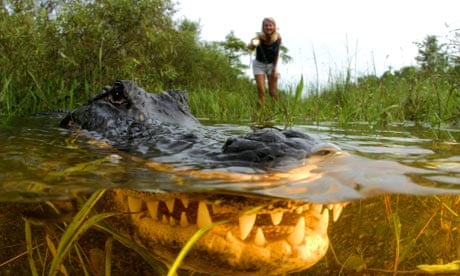
So that system of ditches and dikes I have been talkin’ about, includes a few highways, and sure, again, around the edges, they have been closing off and modifying a few ditches (canal’s as they are referred to) like mentioned before in part two, and a few minor project I haven’t mentioned like changing the flow of water into Biscayne Bay National Wildlife Refuge, not to be forgotten next to his bigger federal brother the Everglades National Park, or the big tank they are building to replenish the everglades aquifers with settling waste water after they get pumped away to satisfy south Florida’s thirsts, but if you had to identify one dyke and canal combo that is stopping the main flow to that aforementioned bigger federal brother, the poster child, the golden hope, it is the Tamiami Trail, US 41, the classic everglades highway, dotted with air boat tours and alligator farms where you can watch some good cracker on gator wrestlin’ action for what might set ya back 30 bucks or so.. it’s the least obscure but perhaps most iconically satisfying of the Florida back roads, the road so interesting it seems to even give the traffic guy a smile every day to say it’s name.. the Tamiami Trail. It’s got Indian Casinos that got their tacky second rate infamy for claiming the Marylin Monroe of the 90’s, Anna Nicole Smith (Bigger, Bustier, and Uncut!), Goodland where the west coast of Florida Midwesterners troop for a good time show, and the subtropical forests where the orchid thief plied his trade, it’s a regular Florida icon bonanza, but it might as well be the Glen Canyon Dam to the Everglades NP’s Grand Canyon. It is blocking off the flow of water to such a degree that along with all it’s northerly cousins, it’s been estimated that in total the lands in the park are getting 5% of their original flow… and that that is changing the composition of the ecosystem so dramatically, with everything from salt water intrusion to species composition change, that it might as well be a different park for all who have to live there even though to the untrained eye it is the same place, hot, flat, buggy and filled with some sort of grass…
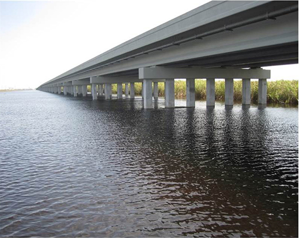
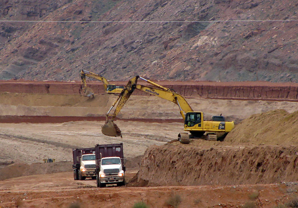
So who is the savior that is coming in to change a problem that the experts see.. well, none other than Ken Salazar, the Department of the Interior, the South Florida Water Management District, various funding sources of the Federal Government, and of all things the Florida Department of Transportation… and how are they going to start restoring the flow, as all the culverts on the Tamiami trail now spout with huge head pressure during the rainy season but it still isn’t enough.. you got it! Another big public works project, but you gotta spread the fat around to get something done in Florida.. Here it is, the Shark Slough Restoration Project elevated road bed!

http://photojournalclydeniki.blogspot.com/2011/10/society-of-environmental-journalists.html
http://www.tampabay.com/news/environment/wetlands/tamiami-trail-bridge-restores-flow-to-everglades-but-it-wont-be-enough/1198510
http://www.naplesnews.com/news/2009/dec/04/work-starts-81-million-bridge-part-florida-evergla/
http://media.naplesnews.com/media/static/bridge_project_plan_view.jpg
well, doesn’t look completely stunning.. umm.. well here was the original set of options
http://www.nps.gov/ever/naturescience/upload/009032009FinalPowerPoint.pdf
You can see, if you wade through some 90 pages of, well, actually, kind of geeky cool graphics, that they had a lot of options put on the table..one of them called for 6.5 miles of bridging, likely a 2 billion dollar project… and heck, if we had all the money in the world, might be fun to make the whole thing a causeway, or pay for planes or hovercraft to take you from Naples to Miami so you can put some money on that Jai Alai match in Dania and make it back in time for Bingo, but umm.. times are tough, and a start is a start..so they.. umm.. picked the cheapest option… but a start is a start!
if that 90 pages wasn’t enough for you, vacuum brain, here is the rest of the discussion:
http://www.nps.gov/ever/naturescience/nessrestoration.htm
now since I am pretending to be the expert here, I must admit that I can’t for the life of me figure out what the Miccusokee’s are crowing about, not sure what their angle is, but I will say for the record, reservations on a bunch of nitrogen being dumped in as well aside, that this must be good for the Everglades, but in Florida, God bless it, nothing is ever quite what you expect.. but hey, the gator’s don’t complain, the law man does what he will, and I bet the fishin’ improves.. in fact, that reminds me.. I’m gunna grab my rod and head out..
The 1 mile bridge is set for completion this summer some time, 2013.. they are a workin’ on it as we speak:
http://www.saj.usace.army.mil/Media/NewsReleases/tabid/6071/Article/6614/early-morning-road-closure-on-tamiami-trail-dec-3-and-dec-5.aspx
they’ll lift up the barriers and let her rip.. we’ll see what happens then..
T minus 3-9 months and counting, sometme from Summer to December of 2013 the one mile bridge should be flowing. They are building the road deck as we speak, then they pull out the old levee/road and voilâ:
http://www.evergladesplan.org/pm/projects/non_cerp_sf_projects_tamiami.aspx
Oh by the way, them government boys are already askin’ for them 5.5 additional miles of bridges.. so don’t worry, us gators are waiting patiently..
http://parkplanning.nps.gov/showFile.cfm?projectID=26159&docType=public&MIMEType=application%252Fx%252Dpdf&filename=EVERTamiamiTrailModifications_FEIS_post_chpts1to6%2Epdf&clientFilename=EVERTamiamiTrailModifications_FEIS_post_chpts1to6%2Epdf

Epilogue:
Finally, May 15, 2013.. the scoop that set it free!

Oh and, I guess it was considered a success, even by Tea Party standards,
http://www.keysnet.com/2013/09/04/489780/90m-okd-for-glades-bridges.html
because the Governor found 90 million to match federal cash for a 180 mil total to build 2.2 more miles of bridge during the 1013 budget season.. I guess fiscal austerity will have to wait a bit. Thankfully this swampland boondoggle will make a few gators happy, and not just a few construction companies!

Categories
Uncategorized

Why So Long? The 2 interconnected reasons why the Sierra has gone unclimbed for 20 or more years

So why so long.. in so many countries,maybe it’s Yuppie ambition, a chance to prove the leisure pursuits of your society, but it’s rare a mountain that is a superlative in a place goes unclimbed for too long. Heck, I once climbed the highest mountain in East Timor, which is a country of 1 million, but it had infrastructure to get to the top and a trail. A guide was 10 bucks for a half day affair.
The Highest Mountain in the United States and North America, perhaps in part due to the 7 Summits phenomenon launched by the Texas Billionaire Bass Brothers with their endeavor and book by the same name back in the 80’s, is called Denali or Mt.McKinley, and it has 5 guide services plus independent parties from all over the world attempt it, usually about 1300 people per year attempt, and annually about 500 make the summit, sometimes dragged along by their guides, but nonetheless successful. Such infrastructure exists all over the world, from the Himalayas to the Alps to the Rockies, and in South America in places like Aconcagua, Bolivia, Ecuador and Peru, and in Colombia supposedly in Bucaramanga.. so why not the sierra…
Well, i’ll toss out a first casual reason, not the two I plan to explore in greater depth in a moment, but it’s an 18,000 ft mountain, 5700 meters, and that is about 1000 meters or 3000 feet past anything an armature would want to polish off in a day or two.. it’s up there in a realm that puts it amongst the biggest things on earth, and even though it is in a tropical zone, it’s high enough to be very tough from the perspective of altitude, the possibilities of HAPE and HACE, and the sun in punishing.. It’s not in the much vaunted ‘Death Zone’, the stuff of Men’s Health and Outdoor Magazine tabloidal legend, which lies about 26,000 ft.. in fact, I’ll legitimize all the hype with an actual Wikipedia Article about it..
http://en.wikipedia.org/wiki/Effects_of_high_altitude_on_humans
but it’s high enough that it isn’t a Colorado 14er on a weekend.. not to be, well, tabloidal,but you can die at these altitudes from exposure and altitude issues alone, even if preserved from the additional hazards of alpinism. But these reasons enough haven’t prevented people from climbing many a similar and higher mountain in thousands of places around the world.. so what is it preventing people from going up there?

Two Buzz Words..Sacredness, and the FARQ.
For the uninitiated, Colombia has been engaged in a Civil War for some 50 years, and longer if you delve into what is a long national history of fratricide, driven by a theme that will be familiar to many Americans, two political parties, one of the landed gentry for a long time, and the other of the lower class and intellectuals, basically the conservatives and liberals, a bit more complex than this, but the conservatives drawing their lineage from the beliefs of the National Liberator, Simon Bolivar, and the Liberals believing in the somewhat more law based opinions of his main rival, Santander.
http://en.wikipedia.org/wiki/Francisco_de_Paula_Santander
To place them in another context, in Mexico, Santander would be Benito Juarez, and Bolivar some combination of Cortez and Porfirio Diaz, or in the US, Santander as a vindictive Thomas Jefferson to Bolivar’s somewhat less restrained George Washington. All this to say, that at some point, the followers of Santander and a more extreme group that started to consider itself communist, broke off after an incident in a place called Marquetalia
http://en.wikipedia.org/wiki/Marquetalia_Republic
and began waging a war against the government organized as a group called the FARQ.They fully embraced a communist ideology supposedly in 1980 at their 7th congress. There were two other significant Left wing insurgent groups in Colombia, M-19 and ELN, but the FARQ and the Colombian Army are the Major Role Players in the Sierra Nevada, and the paramilitaries were but are no longer a significant factor that I could find, other than as a persistent memory for some.
As the FARQ expanded, financed by some assumed combination of cocaine revenue, protection rackets, and support from Soviet Block countries and perhaps even the Peruvian and Venezuelan Governments at times as has been alleged, they opened what they called Fronts around the country in Rural Areas. The one in the Sierra Nevada De Santa Marta, Front 59, at one point had more than 800 members I was told. I will reveal the present disposition in a post entitled Current Security Situation.
In 2002 there were major combat operations, with the military moving into the sierra to displace the FARQ. They removed them from many a town, including Pueblo Bello without a fight, but between La Minah and Guatapuri, 200 people were killed in everything from Executions to Infantry Combat. The people there are relaxed enough, but there is a way in which they can be comically indifferent which seems to be a defense mechanism against the trauma, and this behavior just a few valleys away on either side of the Sierra was not evident. The Operations were ordered under the NEw Administration of President Uribe, who got elected promising to take down the FARC, who amongst other things had killed his father when he was younger in rural Antioquia. The FARC at it’s high point literally administered to some degree 10% of the municipalities in Colombia, and it wasn’t all in once place, they were all over, including Guatepuri, Pueblo Bello, and i have even heard they ran Palomino to some degree, and definitely the villages above it. I have seen the same phenomenon at work in the Darien Gap, where the FARC are the de facto big brothers of the Indigenous groups who live closest to the colombian border, away from Panamanian infrastructure. The Sierra Marta was a FARC territory, and they liked and treated the Koguis quite well from what I have been told, but killed more than a few Arawaku and Kancuamos, and I would assume they treated the Wiwa’s similarly to the Koguis.. I have had Arawaku’s and Kancuamos tell me they were quite pleased to have the Army come in 2002, although it has accelerated the forces of westernization in some of the towns, the Koguis and Wiwas are blissfully indifferent to this, and the Arawaku’s have a sophisticated combination of ways to deal with maintaining their lifestyle while working with the outside world. Like I will describe later, the Kancuamos have been westernized since long before the FARC came around.
All this to say, that as nice as the FARC might have been to some, most mountain climbers tend to be from the Elite or Bougoise, and these are not people who should be messing with the FARC, it’s like a mouse teasing a cat, and it didn’t happen. There was one famous exception, a group headed to the Ciudad Perdido (Lost City of the Tayrona Culture, the predecessor culture to the present day indigenous groups which peaked and fell in pre colombian times, rediscovered in the 70’s, and a popular tourist trek from near Santa Marta and Minca), which seems to have continued tour operations even as the war raged in some sort of truce, were kidnapped by a combination of the FARC and ELN in September 2003, no doubt when the Uribe ordered offensives were creating pressure, officially as a protest of alleged human rights violations by the military and paramilitaries. The last of the 8 individuals was released after 3 months. There was paramilitary involvement in the incident as well. Tours resumed in 2005 to the ciudad perdido. I haven’t looked too hard, but I haven’t heard of any other incidents between the Guerrillas and Climbers.
But now I must introduce the Sacredness concept. Many of these tribes will argue that the Mountains are sacred, and cannot be visited by outsiders. This is a tricky ball of wax… Sometimes when I hang out with an indigenous group, i sometimes wonder how much of what I am being told is what they think I want to hear, how much of it might be regurgitated hooey that NGO’s and occasional hippies that come begging for validation from the Mamo’s, because their dad was some businessman prick who didn’t teach them about spirituality, the local term for Religious Leaders or Shamans. Hang out in traveled areas of The Sierra a bit, and you will see these guys, hippies from Bogota looking for answers and a mouth full of Coca focus. Every time I heard this term, I wondered if the whole Sagrado thing was pumped up by outsiders, which the Arawaku’s seem to take seriously on occasion, or was it an excuse to keep people from getting kidnapped by the FARC which would create hassle for everyone. You will notice in Colombia that a lot of people are quite more disposed than would normal in a lot of places in the world to putting up with problems, since for 50 years anyone who complained ended up with a bullet in their head. This sacredness thing gets tossed about a bit.. oh, the Koguis up there won’t let you to the snows, it’s sacred.. oh, well, you’ll never get permission for that particular spot, it’s sacred.
When i hang out with the Arawakus, I feel like if I made a strong enough argument, proved the FARC were gone, and offered to involve them in an ascent, I could get through. With the Koguis around Guatepuri, I feel as if a little help from the military in terms of conversation with the leaders to say there is no danger, maybe even an escort, the Alcalde (the municipal government) and a little money in the local leaders pocket might get me access as well. One Soldier told me i could get up there through Minca, but I am not sure if he was confusing the Ciudad Perdida with the High Peaks region, but I kept hearing the sacredness thing, and I wonder how true it really is, how much they would hold to it, and what combination of gifts, involvement and logic might break through this barrier.. I have some hunches…

Categories
Charlie Steen Cleanup Colorado River Mi Vida Mine Moab Moab Tailings Pile TARP Funds Train Uranium Mine Utah

Move 16 (Million) Tons…: The Shrinking of the Moab Tailings Pile

Merle Travis might have written it:

Paul Robson might have done it best:

Here’s a mining themed version some guy did:

Hell, the Red Army Choir gave it a try:

but no one is doing it quite like the Department of Energy, UMTRA, and Portage Inc. of Idaho are in Moab, Utah right now, times a million, about 5000 tons a day worth..
What the heck am I talking about? None other than the Moab Tailing’s Pile, the byproduct of some 30 years of Uranium Mining, that currently sits in the flood plain of the Colorado River next to one of Utah’s biggest tourist destination hubs.

Before I tell a sad but hopeful story about the pile, lemme set a time and place with the rags to riches to rags story of Charlie Steen, the man who found the mother lode of Uranium in the United States, the Mi Vida Mine in the Lisbon Valley of Utah, about 40 miles to the South East, near the little Mormon berg of La Sal. Don’t confuse him with the Tiger Blood swilling TV hack that never would have made it in this man’s old west! He’s Sheen, not Crazy ‘ol Charlie Steen, who is a legend of a different sort.
Image result for moab tailings pileWhen America started the Nuclear Age with a series of experiments in places like the University of Chicago, Oak Ridge, TN, Idaho, Hanford, Washington, and Los Alamos, NM, culminating in the Big Bang at White Sands (“Now I am become Death, Destroyer of Worlds” quoteth Robert Oppenheimer at the time). From what I can tell, we had to get our Uranium from the former Belgian Congo for the most part to do the dirty deed in White Sands, Nagasaki and Hiroshima. I will leave the meditations on this act to Oppenheimer and John Hersey, because I am trying to depict the Gee Whiz exuberance of the birth of the Atomic age and the Money Money Money that caught up a guy named Charlie Steen, the Charlie Sheen of Moab, who took the town into it’s third incarnation from Indian Village to Mormon Settlement to Nuclear Mecca, which paved the way for the final incarnation, Gateway to Canyon Lands, but not without a little environmental impact.
Image result for moab tailings pileCharlie Steen was a geologist, and at about the time that the US government started promising beaucoup bucks for Uranium, to make our Nuclear Age a home grown affair, in the Aftermath of World War II, he moved his family to south west Utah,because for some reason, from Australia to Namibia to Canada, Uranium seems to like the red rock areas, and Utah turned out to be no exception. Charlie had his own theories about Uranium and Anticlines, a geological feature that is a bit like a dome, and some hole he had dug down 200 feet proved to be his fortune when his family was broke as could be.Charlie couldn’t afford a Geiger counter, so the guy at the Moab Gas Station had to spot it for him when he pulled up in his beat up old truck with a load from 80 feet deep, when he was well past it to 200 ft… He had struck it rich, the counter went nuts, and from this moment was born the crazy legends of how Steen was so sick of doing laundry by hand he would have all his clothes flown to Grand Junction to be Dry Cleaned, and he would fly up over the canyons to watch TV from the back of his plane too, since he could catch signals from Denver and Salt Lake up there… it was a grand time, and Charlie helped fuel the flood of Uranium, sold at top dollar until 1960 when the US Government finally figured out how to buy Wholesale, that gave us the Dr. Strangelove era of a 20,000 warhead arsenal and the growth of the Nuclear age that ended one morning in the 70’s on Three Mile Island.
http://en.wikipedia.org/wiki/Charles_Steen
http://en.wikipedia.org/wiki/Uranium_mining
http://en.wikipedia.org/wiki/Uranium_mining_in_Utah
unfortunately, if you’ll pardon the pun, there was a bit of fallout from all this.. Moab got rich, which is channeled into such cultural gifts and indulgences as Milt’s Stop & Eat:
http://www.miltsstopandeat.com/
people started to discover Moab and Parks were created and the tourists came, and the bottom fell out on the price of Uranium, leading to a pretty seamless transition, violence only being done in the written world, by Ed Abbey who just might have assumed that Moab would have been left just the way it was:
http://en.wikipedia.org/wiki/Edward_Abbey
photoBut the most tangible piece of fallout was this huge pile of Uranium, and given the Merle Travis Song it almost seems too perfect to be true, an estimated 16,000,000 tons of it, so tall you didn’t used to be able to see Moab from north of town when you came in on the Highway from Green River. You see, like in so much mining, The Uranium didn’t come in pure veins, maybe some of it was pretty dense, but they were processing 1400 tons of rock a day on average right there north of Moab to get the Uranium they wanted, and the rest was tossed in this pile on a flat spot by the river, loaded with heavy metals and lower grade radioactive materials, heck, probably some missed uranium as well, and there it has sat, kind of like the chunk of almost pure uranium they once found in a guys back yard in Moab after a fly by with a helicopter sporting a Geiger counter, not obviously hurting anybody, but likely not in the best spot.. as people started to come to Moab for recreation more and more, not just filming westerns and mining bomb bricks , and the nation’s environmental consciousness started to invade even the last redoubts of old school industry like Utah, a plan was hatched to clean it all up. Now the Moab Tailings Pile ain’t a Superfund Site, people point that name around like a rattlesnake points his snout,
http://www.epa.gov/region8/superfund/ut/index.html
but it is being supervised and paid for by the Federal Government, the Department of Energy, as they are to some degree the guys who caused the whole mess to be made in the first place. They are moving the whole pile to some big hole far from rivers where it might even be reprocessed to get just a wee bit more uranium out of it. How much have they moved, well, 36% at last count, about 6 million Tons, so while we’re all another day older and perhaps, due to the TARP spending, truly deeper in debt, I can’t say it didn’t need to be done.
They post updates often. Due to running out of Stimulus Money, they are no longer working winters but are on the move 4 days a week, maintain equipment one day a week schedule, and oh yeah, you can see Moab from the crest of the highway now…
http://www.grandcountyutah.net/pdf/UMTRA_Status.pdf
http://www.gjem.energy.gov/moab/
http://www.new.ans.org/pubs/magazines/download/a_838
Maybe someday soon, the natives of the Future, some funny combo of Mormon, Hippie Raft Guide and Navajo, will be banging drums on that very spot unaware of what had occurred, safely smokin’ dope, makin’ sacred undergarments out of river reeds, and having fun as the river floods once again, free of the contamination Charlie Steen and The Space Age unleashed upon the river.. 2025 if not before…

Colorado River Canyonlands National Park
Colorado River in Canyonlands NP just down from tailings pile

Image result for colorado river
Categories
Alaska Heida introduction Mountain Lion natural reintroduction repoplation Southeast Alaska Tlinkit

A Cougar Addendum: Self Reintroduction to Alaska

As we are learning, or perhaps you learned long ago, the story of the environment and man, and the idea of an ideal state of nature influenced or uninfluenced by man, is a bit of a complicated question…. there is not only science involved here but philosophy.. this is a short entry however, so I will try to cut to the chase..
The Cougar is introducing it’s self, or reintroducing it’s self, to Alaska..
Whether to chalk this up to Hope or Fear is a matter of question, but I’m going to toss it in the Hope category.
http://www.adfg.alaska.gov/index.cfm?adfg=wildlifenews.view_article&articles_id=26
Reason why it might belong in fear: Global warming might be making previously inhospitable territory hospitable, but I kind of don’t buy that in this situation because the lands of South East Alaska, where they are most likely to live, haven’t changed that much.. what a solid land it is… amongst the most beautiful places in the world I might add.. to see the Lynn Canal or perhaps gaze across Frederick Sound from Mitkoff Island with whales breaching is to behold something special.

Now we could get complex and say that perhaps they were out competed by other species, the Lynx and the Wolf, the Bears and the Wolverines, but these species all co-habitate with it all over Canada, or did,and I think they all got along fine with plenty to eat most of the time. It’s a tricky matter to place the blame on indigenous groups, as we tend to assume, and there are kind of post enlightenment arguments perhaps in the first place, although some natives might argue otherwise, that most of the damage in the world was done, if you can call it damage, by Europeans in the post Colombian onslaught of global markets and the unification of all the global techniques for surviving and thriving that has been occurring since 1492.. complex indeed, and made more complex by the book 1491 by Charles Mann, that does inform the reader, if they had made assumptions otherwise, just how complex some Pre-Colombian cultures were, and how extensive their impact on the land might have been. I have some knowledge of the Tlingit and Heida Cultures, and they were a pretty impressive bunch before we showed up, yeah, the totem pole guys, and as much as some of the interior tribes of the great northern areas like the Athabaskans might not have been too culturally complex or tough on the land, there is a chance that the Tlingit or Heida could have gotten together and gotten rid of a bunch of Mountain Lions… anyhow, all speculation, and since the age of the rifle up there, who knows, but I figured I would toss this one in the hope category.. why not… mountain lions are cool…or, to be coldly scientific about my feelings towards felines, as this post kind of suggests, maybe I just have toxoplamosis..
http://en.wikipedia.org/wiki/Toxoplasmosis
Like you didn’t have enough to worry about in the wilds of Alaska, enjoy this too.. I can’t wait to bump into one..`
Addendum September 2014:
20 months after writing this, I had the occasion to talk to a pair of Canadian Conservation officers whose territory appeared to be North West British Colombia. They are basically national game wardens, and they were working the areas along the Cassiar Highway, Rt. 37, that runs behind the Alaska Panhandle to the east. The Coastal Range that backs up to towns like Juneau and Wrangell is an uninterrupted wilderness that the Cassiar, usually only 20 feet wide and barely habituated, a town or settlement every 50 miles perhaps, hardly separates from the wilds to the north and east. I asked these guys about Mountain Lions, which they casually referred to as ‘Cats’ in response, a reference so casual I could tell they were bumping into them. They told me they just had their first issues in Whitehorse, Yukon, which would definitely have been thought of as way too far north, way too cold normally (Whitehorse can get stuck at 50 below F, it’s the Canadian equivalent of Fairbanks culturally and geographically) and that sightings around the Cassiar were becoming regular. The confirms the move. I did speculate to myself after meeting them, the possibility that instead of man displacing them, perhaps wolves might have, when logging both in the Alaska Panhandle and in this adjoining area of Canada was much more intense. It was banned under the Clinton Administration in the 90’s in the Alaska Panhandle, a sweetheart deal for the cruise ship industry which did hurt some local economies, but has benefited tourism perhaps more than compensatarily. Maybe the logging back then led to prey scarcity that had Wolves eliminating competition. I also saw two coyotes in the same area in this visit, also perhaps new territory for them. Their short legs distinguish them from Wolves. Both areas are recovering from all the logging as the Puma’s enter…

Categories
Dead Sea Dead Sea Level Dead Sea Works Evaporation Pans Jordanian Red Sea Project JRSP Red Sea Dead Sea Canal

The Jordananian De-Sal Canal that will fill the Dead Sea back up..

So I love the Ol’ USA, but my posts lately have gotten a bit domestic… Us Americans, we can be a bit self involved.. put 20 guys on the moon, create the Super Bowl and Southern Bar BQ, and all the sudden the rest of the world don’t exist. We do fix problems when we get around to it, and our true freedom of the press, with a few warts through it may have, and our love for the Internets, this system of tubes, makes for easy blogging about just about any endangered hog nose snail, and boondoggle public works to fix a problem we never should have had in the first place under the sun.. Believe me, I understand.. but I do want to bring in some exotic elements here..
The world is a big place, and as we are learning more and more, it’s environmental problems are interconnected, so I feel a need to write about a piece of potential hope someplace else, someplace exotic, someplace complicated.. and I’m not sure it gets any more complicated than the Middle East. Although Jordan is a relatively uncontentious little place, so this story might be kind of cut and dry, and well, distantly hopeful after all.. but ah the setting, what a complex pile of sand it is…ah, Israel, The West Bank, the Dead Sea, lowest place on Earth, extension of the Great Rift Valley, but if the Rift Valley was the Cradle of Human life, than the areas around the Dead Sea do kind of compete for being the cradle of Human Contention.. but nature is neutral to all that, nature either has no opinions, or just kind of wants to survive… we project almost everything else onto it, from needs to value, but it’s fair to say that given that, the Dead Sea is kind of a cool place.. well, not cool, it’s pretty damn hot.. lemme see.. Dead Sea Weather Report…
http://www.thedailyshow.com/watch/thu-july-13-2006/emotional-weather-report
well, that’s kind of it, but this is a bit more specific.. congrats on the record by the way, Middle East!
http://www.google.com/search?q=dead+sea+weather+report&aq=f&oq=dead+sea+weather+report&sourceid=chrome-mobile&ie=UTF-8
So all other problems aside, the Dead Sea, a bit like the Aral Sea now famously, is shrinking, rapidly, and it’s not a natural occurrence..
what is happening is that an Israeli firm set up a Salt Works on the south end of the Sea complete with some big evaporation pans, actually, more like a potash mine, and it has dropped the level of the sea precipitously… 1 meter a year in recent times.. there is an eerie photo I once saw of a hotel from the 60’s that used to be beach level, but however is now like 30 feet up, but I can’t seem to find it, perhaps the hotels that do exist somehow managed to get rid of it, but here is some data:
http://saveoursea.org.il/?p=329
http://www.h2ome.net/en/2011/03/the-blue-peace/
http://guyshachar.com/content/blog/2011/live-dead-sea-photos-from-a-winter-day/
http://en.wikipedia.org/wiki/Dead_Sea
scroll down to the environmental bits if you want to skip all the history..
Anyhow, so it’s coming apart, turning into the Salton Sea or the Aral Sea, one of those disasters that you hear about but few go to see, but oddly, about a million people a year go to float there, it’s kind of a pass time in Israel, go down and turn your hair all kinky…. they just keep building the hotels closer and closer, and tearing down the old ones, or now they are even splitting the salt pan level from the northern part of the sea so they don’t have to move the hotels,
http://www.restorationplanning.com/deadsea.html
The Dead Sea Works, the company that evaporates most of the water, allegedly went on a huge ‘Greenwashing Campaign’, to displace blame, but their production goes on as usual
http://www.iclfertilizers.com/Fertilizers/DSW/Pages/BUHomepage.aspx
and no one has done anything about the falling sea levels, yet..
There was once a proposal to create a ditch from the Mediterranean, then somehow siphon the water over the mountains and down to the sea..it was supposed to cost about 2 billion dollars, but it never took off.. there was a lot of controversy in Israel, where survival is always placed first, and money is always purported to be tight… despite a fairly good environmental record amongst the Israelis, who love to plant trees anywhere they can.
http://en.wikipedia.org/wiki/Mediterranean%E2%80%93Dead_Sea_Canal
But they also love to and need to farm, and they are like California, siphoning water from everywhere.. I have seen the Jordan River at it’s source, the outflow of the Sea of Galilee where Jesus was supposedly baptized by John the Baptist, and it’s a nice enough spot, but it’s not a big river.. I was able to do a full crawl up it, and there are a few rope swings, but it only comes up to ones chest at deepest, and is just 30 or so feet across..if it ain’t for Israel being so small, and the history surrounding the Jordan being so big, trust me, you never would have heard of it.. There are thousands of bigger rivers around the world, and I saw the extent of the agricultural use even just at it’s source..
So what to do…well, across the sea in Jordan, the quiet little kingdom by Middle Eastern Standards, a bit like Oman, that actually has a caring monarchy and some charm, there is a need for water, and although the merits of desalinization are questionable, if they have an appropriate place to discharge the briny water, and they can produce the clean water with renewable energy, since the sea level is going up it’s not like the Ocean will mind too much… are you thinking what I am thinking.. well, Jordan is:
http://www.jrsp-jordan.com/
http://www.haaretz.com/news/national/is-the-red-sea-dead-sea-canal-about-to-become-reality.premium-1.494217
http://static1.dot.jo/uploads/repository/f7fd77c82e35fa4eb17b311b0bc092d498b864c2.jpg
http://jordantimes.com/article/implementation-of-jordan-red-sea-project-to-begin-early-next-year
http://e360.yale.edu/feature/the_dead_sea_is_dying_can__a_controversial_plan_save_it/2551/
http://en.wikipedia.org/wiki/Red_Sea%E2%80%93Dead_Sea_Canal http://static1.dot.jo/uploads/repository/f7fd77c82e35fa4eb17b311b0bc092d498b864c2.jpg
So there is controversy, no doubt, but something has to be done, and I will admit that if you can’t halt agriculture, or get them to stop using the evaporation pans, which would be the biggest help, this project just might do the trick..hopefully with a little environmental vetting.. it ain’t perfect, but they are a long ways down a bad road, and there aren’t many options to just turn around…
There is some funny power to this story, as with each minute that passes, the area around the Dead Sea sets new lows for the world… I’m just talking about altitude, of course… but let’s try to raise the level a bit here, shall we folks..

Categories
Uncategorized

Photos of Chris’s Peak

http://ko.advisor.travel/poi/1003/gallery
when you see a lake, it appears to be from the south.. when you see black rock slides, I think that’s the north face… when you see a glacier, I again think that is the south side…
http://www.andes.org.uk/peak-info-5000/colon-colombia-info.asp
for some reason I love this picture in particular..I imagine what it was like to go up there in the 70’s and 80’s:

20130118-215905.jpg
http://www.andes.org.uk/peak-info-5000/colon-colombia-info.asp
and this one intrigues me as well, showing both Chris and Simon (Pico Simon Bolivar), chillin’ in the afternoon sun..

20130118-220057.jpg

A Link to photos of the highest peak of every country in the Americas:
http://www.taringa.net/posts/imagenes/13584798/Puntos-Mas-Altos-de-America-_por-paises_.html

Can’t say the Sierra Nevada de Santa Marta is the prettiest one,but it is one of the highest…

Categories
Uncategorized

Approach 3: The Long Valleys from Guatapuri

This appears to be the most conventionally promising, although it ain’t easy, and requires a consistent hike up either of two long Valleys Running east west from what appears to be an old glacial junction near the village of San Jose, about an hour in by foot from the Road Head in Guatapuri, which is at about 5000 ft. the Road is Paved to Pillal more or less, and pretty much paved from Pillal to Atanquez, but from there it is a combo of cement tracks and dirt to Guatapuri, where you set out on foot through this Kancuamos Village, essentially modern, up the Guatapuri River (which runs down below town all the way to Valledupar, as the town straddles a divide between two watersheds, the one you were driving through from Pillal and Atanquez and La Mina, that you crossed at a popular swimming spot, being the Rio Badillo ). the last part of this road is best done in a raised vehicle at least. I did it on foot half way up and all the way down from Atanquez, and it’s not horrible, like the road from Pueblo Bello to Nagusimake, but I had to jump off the guy’s motorcycle a few times when it got rocky towards the top (it wa getting dark, the ride was cheap, and kind of fun I won’t lie) There is regular service in a bunch of old Land Cruisers to Guatapuri and it’s sister town whose name now escapes me, a few hundred yards to the left from the last junction which is pretty much at the town by the school and the pass into the Guatepuri valley.
It looks like about a two to three day hike to base camp from here,but it also looks like a beautiful hike up a deep valley. The Valley to the North, the Guatapuri, has a series of lakes that would no doubt be pretty. The other river, which seems to be called the Donachui, is the southerly of the two Long Valleys, and is a little trickier to get into from the Pueblo of Guatapuri, since you have to go over a bit of a pass. I can only imagine what it holds for beauty. The two mountains are split by a mountain called Sinimin, which is over 4000 m, and has the appearance of a Papal crown. It would be about 20 miles up each of them to the 5 Blue Lakes, with a 7000 ft elevation gain.. steady hard work.. You are above tree line pretty quickly it appears, as these deep valleys don’t seem to allow a lot of sunlight, maybe at 7000 ft from what I could tell.
San Jose seemed to lie at about 6000 ft, and is the last outpost of Civilizados in the Guatepuri Valley, the nickname for educated non indigenous people from the low lands. There are basically two nurses of sorts, a male and a female when I was there, who look after the Koguis in this valley. the buildings in San Jose are a combination of cement for them and thatched huts for the chief who lives there with what might be a bit of a harem, Jose Gabriel I believe was his name. I didn’t talk to him but saw him, and he was an older looking Kogui with a wry smile it appeared. Going furthur up this trail would involve either sneaking past or massaging him, and the first step would be engaging the local municipal head in Guatapuri whose name is______
From there, maps show a few more settlements, then just a long streatch of steep valley running west to join a plateau where the 5 Blue Lakes are. There are a series of Lakes as well in the Guatapuri Valley, the Donachui might have one or two but is mostly river. I have no idea how passable they are, or how difficult it would be getting from the head of the Valley to the plateau, or if they valley walls might be so steep that it becomes impassable, or whether there are boulder fields or waterfalls or cliffs that block the valley.. the only way to find out I guess is to go there or find someone who has… My instinct tells me that the north Valley, the Guatapuri, is the most straight forward of the two, to the lakes. When I asked a guy in Guatapuri how far it was to the sierra, he motioned towards the Upper Guatapuri Valley and said 2 days.. that just might mean “we have big parties up there all the time!”


Categories
Uncategorized

Good Sources of up to date Information on Colombia in English

A Climber should be able to just focus on the Climbing, but this is colombia. I have found that as I settle into the country, I find myself catching things on the news and wanting to know what they are talking about due to the limitations of my spanish, and I started to search for sources of info. my spanish is good enough for conversation, but the News is on a higher level of vocabulary is my excuse.
http://colombiareports.com/
Colombia Reports has turned out to be quite handy. If something happens, anywhere in Colombia, and it is potentially news worthy nationally, which includes almost every guerrilla/terrorist act, criminal organization, plus a lot of other things and even some humor, they will cover it. What also makes it nice is that it functions a bit like a data base, so you can read about a place, and the place and department name will pop up on top, and you can use this to research back into a place. This is helpful because it will tell you how ‘active’ a place might be if it isn’t just local crime, which foreigners tend to be a bit immune to in Colombia.
For deeper insight there are a few:
http://talkingaboutcolombia.com/
there might be a slight liberal bias here, but 50 years of civil war, and more troubling, growing up in Canada, will do that to you!
This blog appears to be written from Bogota by a Canadian raised Colombian named Paula Delgado-King.. like all Colombians, she looks cute!

Home


insight Crime is an interesting idea. I picture a bunch of guys dedicated to the truth behind a very locked door, hopefully someplace in the states. I bet they rarely order pizza from the office.. the coverage is good, including of colombia, but it intelligently treats all of Latin America as once place for the sake of understanding how drug trafficking, the overarching story here, involves the whole region. There is a similar focused just on Mexico called Borderland Beat, but this is about climbing, so I will focus on that.
justf.org/blog
Just the Facts is officially supposed to just cover US activities in Latin America, which it does well, and without much bias from what I see.. it also covers news and trends that might be seen as diplomatically worthy.. you can get a sense of how governments see what is going on. Again, not exclusively focused on Colombia, but interesting.
Speaking of Climbing, Peakery does display some info on colombian peaks:
http://peakery.com/cerro-boquinete/

Categories
Uncategorized

Maps

Again, the issue here appears to be that you can buy maps maybe in Bogota, reams’ of em, but not so much here… although thinking like the locals to some degree means thinking in terms of trails and valleys and rivers, not maps, but I am ready for a good map.

Google Earth
It supplies some good info, but not really useable for navigation. Things are put in the wrong places by armatures (armatures Donny!), and as much as it is fun to play with, the detail is not there. There are also issues with cloud cover in the pictures. The one that streams to PC’s gives you altitude and other helpful things, which is better than the dumbed down version on this IPad.

Falconview.com
I seems to be the best online mapping resource, and looking at it for about one second taught me something I wanted to know about the long valley approaches. It’s a 200 mb download to a PC. I had never heard about it before,but a young Army Officer I met up in the Sierra told me it was what they used, so I might as well also. I downloaded it to the PC in my hotel,but couldn’t get it to work, but from what could tell, this is the gold standard for Internet mapping in Colombia, and perhaps the world. There is no Tablet Version yet for nonmilitary.

Military Maps
Without going into detail, I was given access to a pair of military maps with a lot of info that was fascinating on the security situation, but I would describe the maps as better than average but not good enough to navigate by. The scale on these maps was like 1:100,000 or 200,000, and a centimeter was a kilometer, so as much as it offered a cool overview, it wasn’t good enough to use, say, to get in from the north over open country. But given how you need to rely on local knowledge and you end up following Indigenous foot trails anyhow, it might do in a pinch. I wonder if they have maps on the 1:24,000 or so scale for real operations, and if I could get these… Bogota again would be my guess…
It did however have the name of every river and native settlement of more than maybe 100 people, the best I have seen so far. I was allowed to take pictures of these maps which I will post soon.

The Maps in the Library:
There were two in the back of the Library of the NAtional Bank (literally on the second floor of what is like the Colombian Federal Reserve Branch on Carrera 9 (9th avenue) and Calle 16 (16th St) in Valledupar.
One was a three-dimensional multi colored graphic which highlighted the vertical dimensions of the Sierra from the South West perspective, and another seemed to focus on Indigenous areas, and was mostly brown, and did have some detail.

Categories
Uncategorized

A Review of the Literature

There Seems to be only a handful of Books about the Sierra.
My search so far has been limited to information available on the Internet, and the Library of the National Bank of Colombia here in Valledupar
The library had a handful of mildly useful things, including a few maps that were actually on the wall. There were some books on Natives in Colombia, a few were overviews or surveys with only a page or two dedicated to each of the tribes here in the Sierra. It’s said that Bogota is where everything is, and that finding things like book stores is difficult everywhere else. There are two libraries in Valledupar, and the bigger of the two was randomly closed when I showed up. When I asked the security guard why, implying that it sounded like a corrupt cock up, he kind of smiled that smile that said you’re right, but having grown up in Colombia, I would never say that,but I am kind of excited you said it!

Wikipedia:
it has what it has… the entries in Spanish appear to be a lot more rich in detail.. maybe it’s time for me to take my spanish to the next level, hey babe!
http://en.wikipedia.org/wiki/Sierra_Nevada_de_Santa_Marta

Expeditions:
I have found two, one seems to be translated into spanish from some european langauge, and is account of a guy named Plouffie or something like that who went into the sierra from the Coast along the Palomino it appears in 1916.. it has a lot of discussion of Koguis and Arawakus, much of it anecdotal. My spanish is just barely sufficient for this kind of prose, but I saw a bit on how bug bites had him laid out for a month due to infections in his feet, which rang true for me since the only reason I was in the damn library is because I am limping with a foot infection as we speak.

William Sefriz from the University of Pennsylvania seems to have gone up the mountain from the Caribbean in 1934. I have to work up the courage to shell out the 12 bucks to read his book, and it’s likely worth it, I just hate the drudgery of e commerce! I’ll get it eventually..
http://www.jstor.org/discover/10.2307/208919?uid=3737808&uid=2460338175&uid=2460337935&uid=2129&uid=2&uid=70&uid=4&uid=83&uid=63&sid=21101425144893